
INTEGRATED WATER TRANSPORT SYSTEM FOR THE CITY OF KOCHI
75+
E-Boats
15+
Routes
75+
Kilometres
WATERWAYS - KOCHI SCENARIO
The Kerala backwaters are a network of brackish lagoons and lakes lying parallel to the Arabian Sea coast (known as the Malabar Coast) of Kerala state in southern India, as well as interconnected canals, rivers, and inlets, a labyrinthine system formed by more than 900 kilometers (560 mi) of waterways. Kochi is the largest city in the south Indian state of Kerala and the second largest along India's western coastline, after Mumbai. In Kochi's case, thanks to its location on the lower west coast of the Indian peninsula, it is less vulnerable to storm surges or cyclones compared to cities on the eastern coast of the country. The city sits within a complex estuarine system comprising Lake Vembanad and the many rivers flowing into the lake, including the Periyar and Muvattupuzha rivers.
WATERWAYS AND IDENTIFIED ROUTES
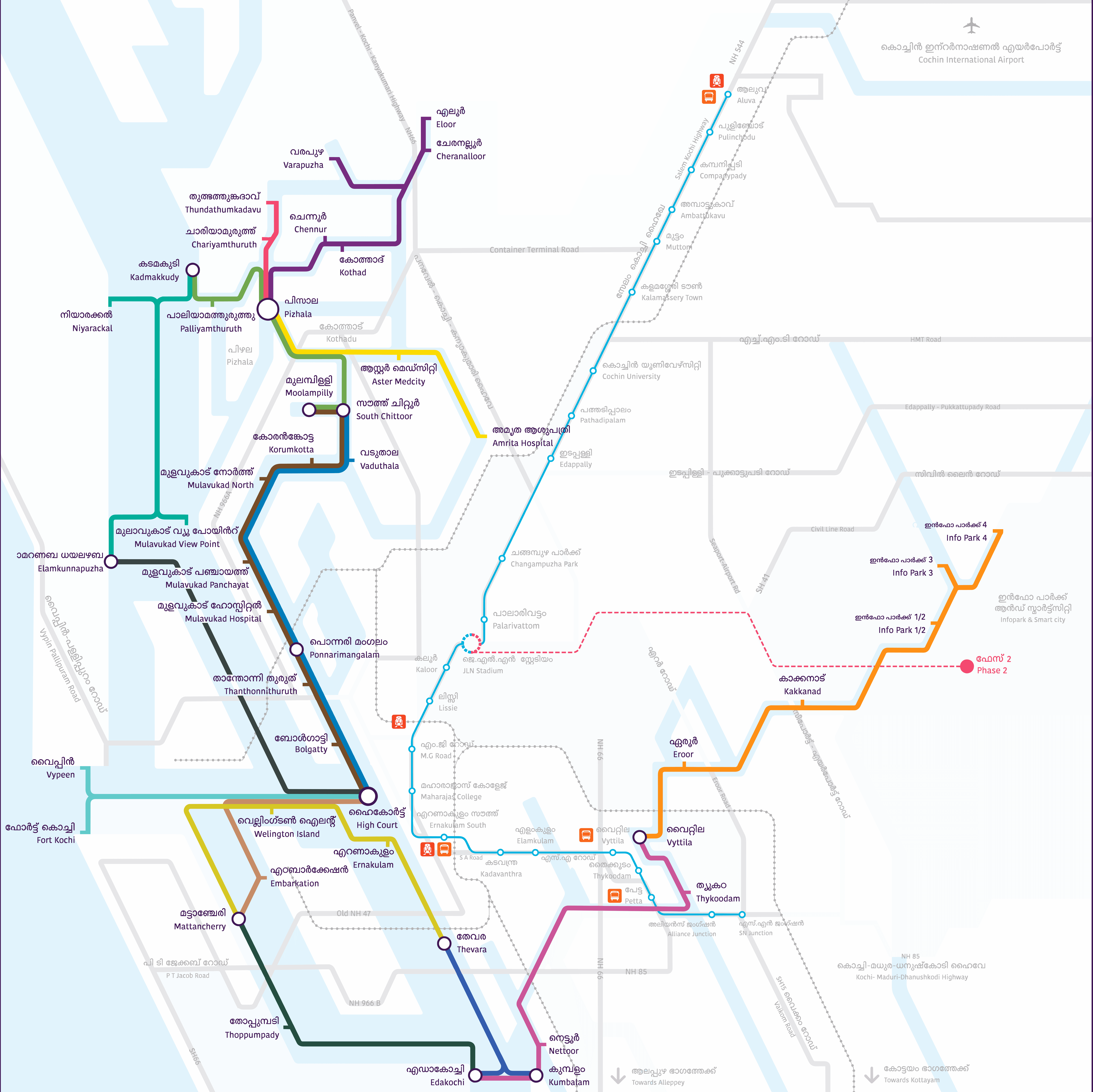
The project is intending to use the inland waterways in and around Kochi the major share of the waterways are - National Waterways ( NW3) - 40%, Cochin Port Trust Waters - 33%, existing routes under irrigation - 20%, other inland waters -7%. The proposed Water Metro Project comprises of fifteen (15) identified routes connecting thirty eight (38) jetties across ten (10) island communities and 2 boatyards. The overall length of the line lengths of these 15 routes is 76.2 line kilo meters. The water depth required (-2 to -2.50m CD) in channels and - 1.50mCD in approach and jetty pockets. Since major part of the channels are already in use, dredging in these are not significant whereas the approaches from the navigational channel to the terminal area constitute the main part of the dredging. The total dredging is estimated to be in the range of 0.65 million cubic meters.
There are 15 routes planned as part of this project. These are highlighted in the sketch shown below. The headways shall vary between 10 minutes to 20 minutes across various routes at peak hours. There will be Navigational buoys and night navigational assistance throughout the routes. Water weed and floating waste management is envisaged in this project.


Reports
© 2025 Kochi Water Metro|Developed by Ilahia College of Engineering and Technology
